
LAND SURVEYING SERVICES
Cutting-Edge Surveying Solutions by Expert Geodetic Engineers
MLD Engineering and Surveying Consultancy is composed of licensed Geodetic Engineers utilizing state-of-the-art equipment to deliver highly efficient field data collection and layout services for our clients.

Relocation Survey
conducts to re-establish or verify the exact location of property boundaries based on existing legal land descriptions, titles, or survey plans. It involves physically locating and marking boundary corners or lines on the ground using survey instruments and referencing official records from government agencies such as the Land Registration Authority (LRA) or DENR.
The purpose of a relocation survey is to ensure that land boundaries are accurately defined and to resolve any uncertainties, potential encroachments, or disputes. It is commonly required for property transfers, fence constructions, building permits, and legal documentation.
Topographic Survey
detailed and accurate survey that maps the natural and man-made features of a land surface, including its elevations, contours, vegetation, water bodies, roads, structures, and utilities. It is used to determine the terrain and surface characteristics of a site, which are essential for planning, engineering design, and construction.
The survey captures both horizontal and vertical data to create a three-dimensional representation of the site. Total stations, GPS, drones, and other geodetic instruments are commonly used to gather precise data, which is then processed into maps, digital terrain models (DTMs), and contour plans.

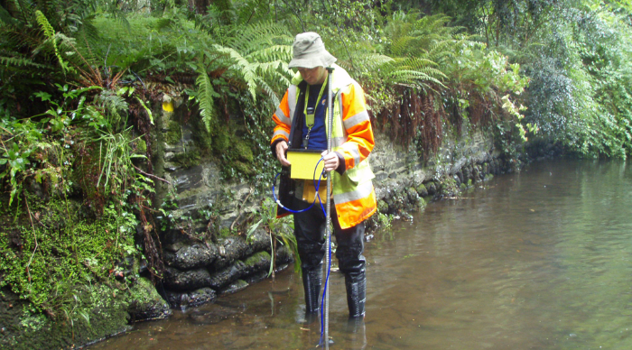
Creek Survey
Assesses and maps the alignment, depth, and surrounding features of creeks or waterways. Often used for flood risk analysis, environmental assessments, and development planning near water bodies.
Tree Tagging Survey
Identifies, locates, and tags trees within a specified area, noting species, size, and condition. Useful for environmental impact assessments, landscaping, and permit applications.


LiDAR Survey
Uses Light Detection and Ranging (LiDAR) technology to create high-resolution 3D maps of terrain and surface features. Ideal for large-scale and detailed topographic data collection.
Preparation of VSR (Verified Survey Returns)
Involves the creation of Verified Survey Returns required for land titling and other legal processes. These are prepared according to standards set by the Land Management Bureau and DENR, ensuring accuracy and compliance.


Preparation of eTD (Encoded Technical Description)
Generates a digital version of the land’s technical description, typically required for land registration and permit applications. The eTD includes bearings, distances, and coordinates formatted to meet regulatory requirements.
Location/ Sketch Plan or Lot Information Plan
Provides a visual representation of a property’s location and boundaries, often used for land transactions, development planning, or permit applications. These plans help clients understand lot orientation and relation to nearby landmarks or properties.


Desktop Survey
A Desktop Survey is a preliminary, non-intrusive assessment that gathers and analyzes existing data and geospatial information to evaluate a site’s physical, legal, environmental, and geotechnical conditions. It includes the review of cadastral maps, land titles, existing survey data, aerial/satellite imagery, topographic and terrain data, as well as environmental and zoning constraints.
This study also incorporates hazard maps (e.g., flood, landslide, coastal erosion) to identify site vulnerabilities and assess potential development risks.
Georeferenced maps and terrain models are developed using Geographic Information System (GIS) tools, enabling accurate spatial analysis, data integration, and visualization.
Deliverables typically include GIS-based maps, hazard overlays, terrain models, title analysis, boundary assessments, zoning reviews, and electronic survey files in various formats (e.g., .dwg, shapefile, .kmz, GeoTIFF).
Construction Staking
Marks the exact location of proposed structures and infrastructure on the ground based on approved construction plans. This service ensures accurate alignment and positioning of buildings, roads, utilities, and other features during construction.


As-Built Survey
Captures and documents the precise locations and dimensions of completed construction work. As-built surveys verify that the finished structures match the design plans and are essential for project documentation and future reference.